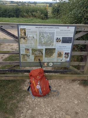
St Morrell's Way is a long distance pilgrimage of about 210km (131 miles) which is inspired by pilgrimage of Edmund Oliver in 1533 from Hallaton to Walsingham. The pilgrimage does not follow the exact route that he took, because parts of that our now major roads, instead it follows quieter paths and represents how we think the route would have evolved if pilgrimage had not been stopped abruptly at the Reformation.
The route starts from the site of St Morrells pilgrim chapel in Hallaton in Leicestershire and crosses the county of Rutland and dropping into the flatter landscapes of Lincolnshire and Cambridgeshire where it follows the course of the Nene river. After entering Norfolk and crossing the Great Ouse river at Kings Lynn, the route climbs again to find the Shrine of Our Lady of Walsingham near to the north Norfolk coast.
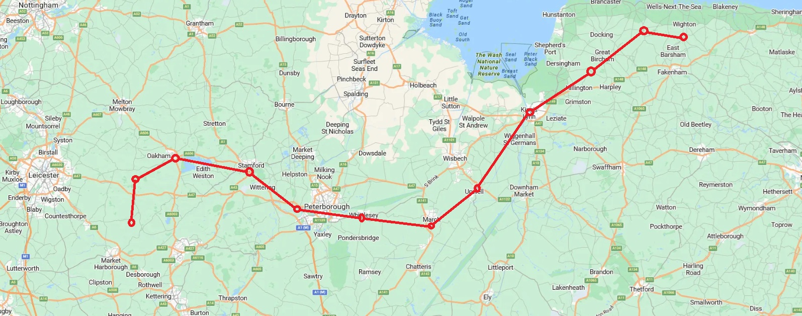
The route is well served by public transport with trains in the West and Buses in the East. There are railway stations at Oakham, Stamford, Peterborough, Whittlsea (sic), March and Kings Lynn. Buses also reach Upwell, Anmer and Walsingham. There are also Uber taxis operating in the vicinity of Market Harborough, Peterborough, March and Kings Lynn.
We walked the route in the late summer of 2025 taking advantage of the excellent transport links to operate from two bases: Oakham in the West and then Kings Lynn in the East. We took ten days to complete the walk although this involved a long 30km+ first day which with hindsight we should have split. Also we had to curtail our fourth day due to extreme heat which resulted in another 30km+ walk on our fifth day. The route described below is for an eleven day walk, which incorporates our "learnings" although the information from our pilgrimage could be used by you to walk as much or as little as you want, and to start and finish anywhere you chose.
St Morrells Way, by accident more than design, also follows, or runs in parallel with, the routes of other long distance footpaths including initially the St Morrells Round, the Hereward Way, and the Kings Lynn to Walsingham path as set out in Andy Bull's book "Norfolk's Pilgrim Routes" (available here) which also provides very useful information about Kings Lynn and the eastern end of the route.
Day 1: Hallaton to Launde. Hallaton is accessible from Leicester, Market Harborough and Oakham by Taxi/Uber and by FoxConnect on-demand-bus from Market Harborough. After visiting St Michael's and All Angels church and/or the Museum, follow the St Morrell's Round (see here) through Tugby, Loddington to Launde Great Wood, which you are recommended to explore, before descending to Launde Abbey. Details of their accomodation can be found on their website. A copy of the gpx trace for this walk is available here.
Day 2: Launde to Oakham. Continue from Launde Abbey along the beautiful Chater Valley before climbing to Hebe Wood and then carry on to Braunceston. From Braunceston climb again steeply and drop to Langham. Chapel close is the site of Edmund Oliver's second target, but there is nothing to be seen of St Helens Chapel. The walk into Oakham is pretty grim. Oakham Castle and great Hall are noteworthy. There is a railway station at Oakham with connections to Birmingham, Leicester, Peterborough, Cambridge, and Stansted Airport see here. A copy of the gpx trace for this walk is available here.
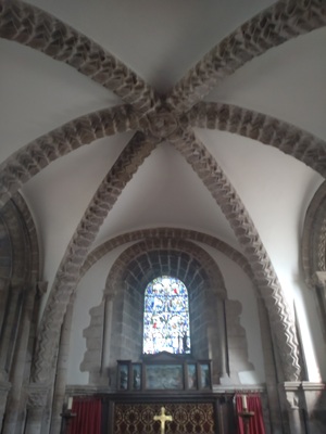
Day 3: Oakham to Stamford. Leave Oakham walking approx 5km beside a busy road to reach the north shore of Rutland Water. There are a few cafes along this path. Follow it all the way to Empingham where you can get lunch and/or buy food. After Empingham the path goes across delightful countryside to reach Tickencote and St Peters Church. This is a must visit site. From here you will shortly reach the A1 and thereafter follows another 5km beside a busy road. Luckily the joys of Rutland Water and Tickencote make the road sections bearable. Then you arrive in Stamford which is choc-a-bloc with interesting Churches it also has a railway station. A copy of the gpx trace for this walk is available here.
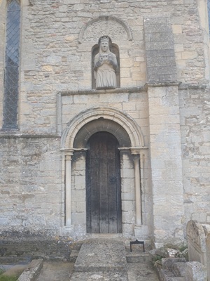
Day 4: Stamford to Castor. Leave Stamford heading south and do not go into Burley House. Continue and turn on to the golf course and follow the path across fabulous countryside. Leave the Hereward way and head to Ufford where it may be possible to get lunch before turning south to the medieval landscape of the Castor Hanglands and then cross the A47. St Kyneburgha's Church in Castor is worth the whole days walk. If you've never heard of her, read her story here. Castor is a short Taxi/Uber ride from Peterborough. A copy of the gpx trace for this walk is available here.
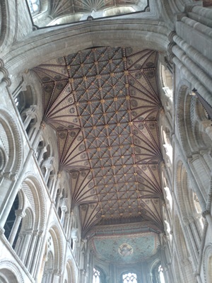
Day 5: Castor to Whittlsey. Leave Castor and follow the course of the Nene to Peterborough and marvel at the Cathedral's facade, oak roof and the Hedda stone. There are plenty of opportunities to get lunch and/or buy food here. After Peterborough follow the north bank of the Nene across Flag Fen before crossing the bridge to head south east to Whittlesey. There is a railway station here that has a slightly different name! A copy of the gpx trace for this walk is available here.
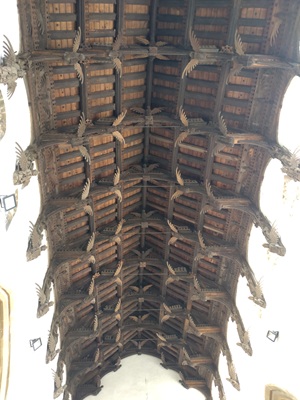
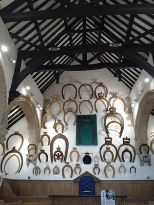
Day 6: Whittlesey to March. Once you leave Peterborough you see the fen landscape and this continues from Whittlesey. At Turves there is the only railway signalbox in hte UK named after a pub. Sadly the pub has been closed. Continue along the river Nene and Hereward Way to reach March. March is a surprisingly big town and it is some distance from St Wenderedas Church in the south to the railway station in the north. There are 118 Angels afixed to the double hammer beamed roof of St Wendredas see more here . A copy of the gpx trace for this walk is available here.
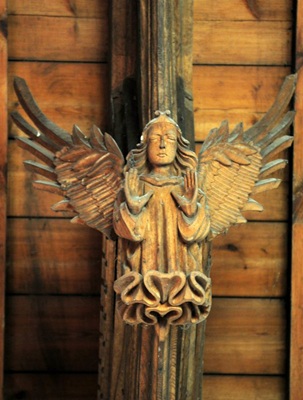
Day 7: March to Outwell. This day should be the day of angels. After St Wendreda's magnificent display the next two churches in Upwell and Outwell both have angels in their great roofs. Unfortunately Outwell with its famous angels was closed for roof repairs when we arrived so I can only show you a stock photo. There is a shop next to St Clements Church in Outwell and you can travel by Lynx bus to/from here March, Market Downham or Kings Lynn. We got an Uber back to March and then caught a train to Oakham. A copy of the gpx trace for this walk is available here.
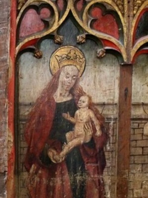
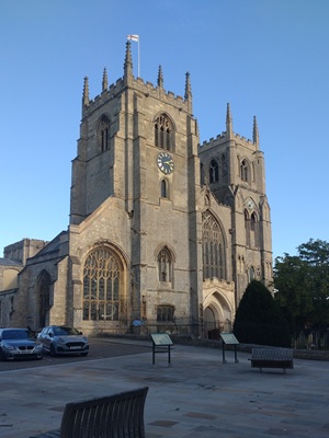
Day 8: Outwell to Kings Lynn. After leaving Outwell Church the route follows a busy road before turning onto a quieter lane and then joining the path along the west bank of the Middle Level Drain. Which it follows in a straight line for over 10km. Just before the junction with the Great Ouse, turn off at Wiggenhall St Mary to find St Mary the Virgin Church. This is another must visit church with its brilliantly painted rood screen. The church is normally closed so you need to make a special arrangement to gain access here . After leaving Wiggenhall continue along the west bank of the Great Ouse to West Lynn where you can catch the pedestrian ferry to Kings Lynn (timetable here) and then walk to its magnificent Minster. A copy of the gpx trace for this walk is available here.
Day 9: Kings Lynn to Anmer. There is enough to see in Kings Lynn on their pilgrimage trail to merit a whole day here. As we left the Minster we visited the Greyfriars tower and the Red Tower before joining the disused Sandringham Railway line north. There is a Tesco Express in North Wotton where you can get sandwiches and coffee just before heading on to Ling Common. The path leads to Castle Rising with the amazing St Leonards Church, Castle and pub. After Castle Rising the route crosses the ridiculously busy A149 and continues through delightful woods to Anmer. The church is interesting and the adjacent house is not only the home of "William and Kate" but is also noted for the martyrdom of Catholics that hid there. There is a bus to Kings Lynn from the cross roads just outside the village. A copy of the gpx trace for this walk is available here.
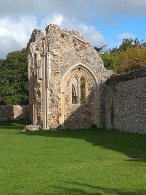
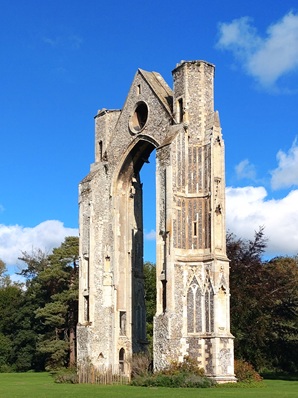
Day 10: Amner to North Creake. From Anmer the route heads generally north east along a quiet field road that leads eventually to Great Bircham where there is a cafe and shop. It continues quietly in the same direction to North Creake Abbey where there is also a cafe. (There is no public transport to/from North Creake, so it might be better to continue Day 9 to Great Bircham and then walk from there to Walsingham.) A copy of the gpx trace for this walk is available here.
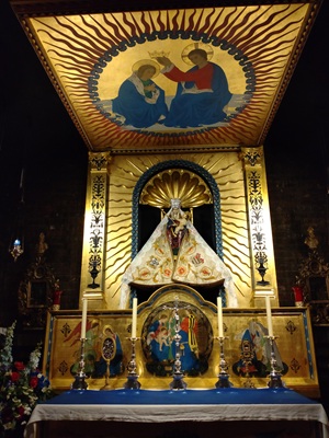
Day 11: North Creake to Walsingham. From North Creake the route continues mainly east along quiet roads eventually to arrive at the Slipper Chapel after which it follows the disused railway to Walsingham, the Abbey and the Holy House shrine. You have arrived: congratulations! There are various cafes and pubs available and there is a return bus to Kings Lynn. A copy of the gpx trace for this walk is available here.